
Observar para ver si evoluciona.


Donde lo posteo? En Twitter?Villafañe wrote: ↑Sat Sep 21, 2019 7:21 am Las primeras imágenes del satélite de esta mañana con bastante convección alrededor de la baja presión... Invest 99l. Veremos que pasa con este prospecto. La oficina local deel SNM puso esto así que pendientes. If this system develops into a tropical cyclone, it could bring tropical storm or hurricane conditions to the local islands Tuesday afternoon into Wednesday.
Lo encontréStormWatch wrote: ↑Sat Sep 21, 2019 9:57 amDonde lo posteo? En Twitter?Villafañe wrote: ↑Sat Sep 21, 2019 7:21 am Las primeras imágenes del satélite de esta mañana con bastante convección alrededor de la baja presión... Invest 99l. Veremos que pasa con este prospecto. La oficina local de
Saludos y buen día!
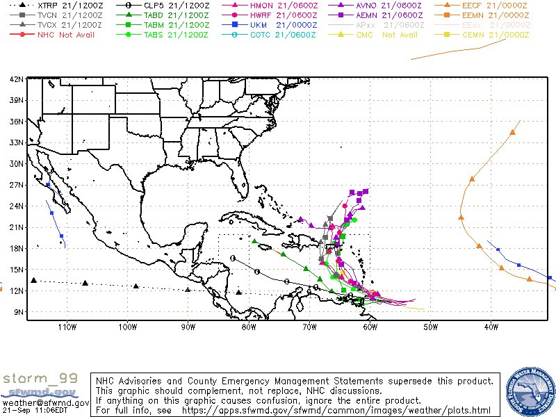


Saludos katrina23... El avión caza huracán voló el sistema no encontró circulación cerrada... pero si vientos de galerna en todo sus cuadrantes, el Invest 99l es posible que continúe mejorando y en especial cuando entre al Caribe donde los vientos cortantes bajarán, su movimiento de translación también, tendrá las aguas súper caliente... hay otro dato, eso es entre nos acá...veo a Jerry debilitándose bastante que es posible que su influencia con este Invest 99l negativamente sea menos, por otro lado los modelos de las 12z comenzaron a ver mejor el sistema incluyendo a el GFS y el Europeo que se ve claramente que cuando lo acerque a
Lo fortalece... yo pienso que este sistema se puede convertir en un sistema ciclónico... seguiremos observando.Gracias muchas graciasVillafañe wrote: ↑Sat Sep 21, 2019 3:25 pmSaludos katrina23... El avión caza huracán voló el sistema no encontró circulación cerrada... pero si vientos de galerna en todo sus cuadrantes, el Invest 99l es posible que continúe mejorando y en especial cuando entre al Caribe donde los vientos cortantes bajarán, su movimiento de translación también, tendrá las aguas súper caliente... hay otro dato, eso es entre nos acá...veo a Jerry debilitándose bastante que es posible que su influencia con este Invest 99l negativamente sea menos, por otro lado los modelos de las 12z comenzaron a ver mejor el sistema incluyendo a el GFS y el Europeo que se ve claramente que cuando lo acerque a

