el prospecto 95l con hasta 60% en 7 días de desarrollo ciclónico, Los modelos de computadora principales en buen consenso de traer un ciclón tropical al Caribe, siendo así pues estaremos monitoreando todo lo relacionado al desarrollo y la trayectoria.
Huracán Beryl entrando al oeste del Mar Caribe
Huracán Beryl entrando al oeste del Mar Caribe
el prospecto 95l con hasta 60% en 7 días de desarrollo ciclónico, Los modelos de computadora principales en buen consenso de traer un ciclón tropical al Caribe, siendo así pues estaremos monitoreando todo lo relacionado al desarrollo y la trayectoria.
Re: Invest 95l con 30%/60% Codigo Naranja
ZCZC MIATWOAT ALL
TTAA00 KNHC DDHHMM
Tropical Weather Outlook
NWS National Hurricane Center Miami FL
800 PM EDT Wed Jun 26 2024
Eastern Tropical Atlantic (AL95):
Satellite images indicate that a tropical wave located several
hundred miles southwest of the Cabo Verde Islands has become better
organized since yesterday with a more concentrated area of
thunderstorms. Environmental conditions are forecast to be
unusually conducive for late June across the central and western
tropical Atlantic, and further development of this system is
anticipated. A tropical depression or tropical storm could form
this weekend several hundred miles east of the Windward Islands
while the system moves westward at 15 to 20 mph.
* Formation chance through 48 hours...low...30 percent.
* Formation chance through 7 days...medium...60 percent.
Forecaster Blake
Re: Invest 95l con 30%/60% Codigo Naranja
ZCZC MIATWOAT ALL
TTAA00 KNHC DDHHMM
Tropical Weather Outlook
NWS National Hurricane Center Miami FL
800 PM EDT Wed Jun 26 2024
For the North Atlantic...Caribbean Sea and the Gulf of Mexico:
2. Eastern Tropical Atlantic (AL95):
Satellite images indicate that a tropical wave located several
hundred miles southwest of the Cabo Verde Islands has become better
organized since yesterday with a more concentrated area of
thunderstorms. Environmental conditions are forecast to be
unusually conducive for late June across the central and western
tropical Atlantic, and further development of this system is
anticipated. A tropical depression or tropical storm could form
this weekend several hundred miles east of the Windward Islands
while the system moves westward at 15 to 20 mph.
* Formation chance through 48 hours...low...30 percent.
* Formation chance through 7 days...medium...60 percent.
Forecaster Blake
Re: Invest 95l con 30%/60% Codigo Naranja
Ensamble corrida GfS 18Z 


Re: Invest 95l con 30%/60% Codigo Naranja
Ha esta hora asi luce el Invest 95l 
Re: Invest 95l con 40%/70% código rojo.
ZCZC MIATWOAT ALL
TTAA00 KNHC DDHHMM
Tropical Weather Outlook
NWS National Hurricane Center Miami FL
200 AM EDT Thu Jun 27 2024
For the North Atlantic...Caribbean Sea and the Gulf of Mexico:
2. Eastern Tropical Atlantic (AL95):
A tropical wave located several hundred miles southwest of the Cabo
Verde Islands continues to produce disorganized shower and
thunderstorm activity. Environmental conditions are forecast to be
unusually conducive for late June across the central and western
tropical Atlantic, and further development of this system is
anticipated. A tropical depression or tropical storm is likely to
form this weekend several hundred miles east of the Windward Islands
while the system moves westward at 15 to 20 mph.
* Formation chance through 48 hours...medium...40 percent.
* Formation chance through 7 days...high...70 percent.
Forecaster Bucci
-
Georges_98
- Invest

- Posts: 230
- Joined: Fri Sep 02, 2016 2:27 am
Re: Invest 95l con 40%/70% código rojo.
Buenos días, Villa! Buenos días al grupo! Excelente volver a leerte. Siempre alerta a los movimientos atmosféricos del área. Excelente leerte. Hay una característica inusual con estos dos sistemas: los modelos han sido bastante consistentes desde el inicio. Y los colocan al sur de la isla o en franca amenaza a ella. Hay un pronóstico de fuerte shear sobre todo en la 55 que determinará cuan fuerte podrá continuar tras su paso por allí. Un gran bolsillo de polvo sahariano parece que evitará sostenido fortalecimiento, pero contará con un aliado poderoso: las muy altas temperaturas alrededor del arco de las antillas en el mar Caribe. Así que todavía cierta incertidumbre en el inicio de esta proyectada fuerte temporada.
Re: Invest 95l con 40%/70% código rojo.
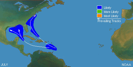
Climatología Julio.