
Huracán María

Re: Huracán María
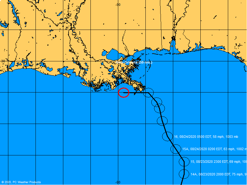
El nuevo rey insiste en azote directo por el sur, está data es muy importante por qué viene de la información recopilada por el caza huracán . Prácticamente nada ha cambiado . Espero que por fin emitan la Vigilancia aún no entiendo por qué no lo han hecho.
Re: Huracán María
Yo voy hacer un pronóstico mío personal de lo que yo pienso que puede pasar. El sistema me inclino a pensar en una trayectoria más al sur de lo que el Euro está haciendo pero bien cerca de la isla. Esto es mi opinión personal para información oficial refiérase al NHC.
Re: Huracán María
000
WTNT35 KNHC 180835
TCPAT5
BULLETIN
Hurricane Maria Advisory Number 8
NWS National Hurricane Center Miami FL AL152017
500 AM AST Mon Sep 18 2017
...MARIA HEADED FOR THE LEEWARD ISLANDS...
...EXPECTED TO BECOME A MAJOR HURRICANE BY TONIGHT OR EARLY
TUESDAY...
SUMMARY OF 500 AM AST...0900 UTC...INFORMATION
----------------------------------------------
LOCATION...14.6N 59.5W
ABOUT 100 MI...160 KM E OF MARTINIQUE
ABOUT 130 MI...215 KM ESE OF DOMINICA
MAXIMUM SUSTAINED WINDS...90 MPH...150 KM/H
PRESENT MOVEMENT...WNW OR 290 DEGREES AT 13 MPH...20 KM/H
MINIMUM CENTRAL PRESSURE...977 MB...28.85 INCHES
WATCHES AND WARNINGS
--------------------
CHANGES WITH THIS ADVISORY:
A Hurricane Watch has been issued for Puerto Rico, Vieques, and
Culebra.
SUMMARY OF WATCHES AND WARNINGS IN EFFECT:
A Hurricane Warning is in effect for...
* Guadeloupe
* Dominica
* St. Kitts, Nevis, and Montserrat
* Martinique
A Tropical Storm Warning is in effect for...
* Antigua and Barbuda
* Saba and St. Eustatius
* St. Lucia
A Hurricane Watch is in effect for...
* Puerto Rico, Vieques, and Culebra
* U.S. Virgin Islands
* British Virgin Islands
* Saba and St. Eustatius
* St. Maarten
* St. Martin and St. Barthelemy
* Anguilla
A Tropical Storm Watch is in effect for...
* Barbados
* St. Vincent and the Grenadines
A Hurricane Warning means that hurricane conditions are expected
somewhere within the warning area. Preparations to protect life and
property should be rushed to completion.
A Tropical Storm Warning means that tropical storm conditions are
expected somewhere within the warning area.
A Hurricane Watch means that hurricane conditions are possible
within the watch area. A watch is typically issued 48 hours
before the anticipated first occurrence of tropical-storm-force
winds, conditions that make outside preparations difficult or
dangerous.
A Tropical Storm Watch means that tropical storm conditions are
possible within the watch area, generally within 48 hours.
Interests elsewhere in the Lesser Antilles and the Dominican
Republic should monitor the progress of this system.
For storm information specific to your area in the United
States, including possible inland watches and warnings, please
monitor products issued by your local National Weather Service
forecast office. For storm information specific to your area outside
the United States, please monitor products issued by your national
meteorological service.
DISCUSSION AND 48-HOUR OUTLOOK
------------------------------
At 500 AM AST (0900 UTC), the center of Hurricane Maria was located
near latitude 14.6 North, longitude 59.5 West. Maria is moving
toward the west-northwest near 13 mph (20 km/h), and this motion
with a decrease in forward speed is expected through Tuesday night.
On the forecast track, the center of Maria will move across the
Leeward Islands late today and tonight and then over the
extreme northeastern Caribbean Sea Tuesday and Tuesday night.
Maximum sustained winds are near 90 mph (150 km/h) with higher
gusts. Significant strengthening is forecast during the next 48
hours, and Maria is expected to become a dangerous major hurricane
before it moves through the Leeward Islands.
Hurricane-force winds extend outward up to 15 miles (30 km) from the
center and tropical-storm-force winds extend outward up to 105 miles
(165 km).
The estimated minimum central pressure is 977 mb (28.85 inches).
HAZARDS AFFECTING LAND
----------------------
WIND: Hurricane conditions are first expected within portions of
the Leeward Islands by late today, with tropical storm conditions
beginning during the day today. Hurricane conditions are possible
within the hurricane watch area by Tuesday, with tropical storm
conditions possible tonight. Tropical storm conditions are possible
in the tropical storm watch area through tonight.
STORM SURGE: A dangerous storm surge accompanied by large and
destructive waves will raise water levels by as much as 5 to 7 feet
above normal tide levels near where the center of Maria moves
across the Leeward Islands.
RAINFALL: Maria is expected to produce total rain accumulations of
6 to 12 inches with isolated maximum amounts of 20 inches across the
central and southern Leeward Islands, including Puerto Rico and the
U.S. and British Virgin Islands, through Wednesday night. Maria is
also expected to produce total rain accumulations of 2 to 4 inches
with isolated maximum amounts of 8 inches over the remaining
northern Leeward Islands from Barbuda to Anguilla, as well as the
Windward Islands and Barbados. Rainfall on all of these islands
could cause life-threatening flash floods and mudslides.
SURF: Swells generated by Maria are affecting the Lesser Antilles.
These swells are likely to cause life-threatening surf and rip
current conditions. Please consult products from your local
weather office.
NEXT ADVISORY
-------------
Next intermediate advisory at 800 AM AST.
Next complete advisory at 1100 AM AST.
$$
Forecaster Pasch
Re: Huracán María
Buenos Dias:
Pienso, quiero y le pido al Dios todo poderoso que este Sistema siga al sur y no nos toque. Esto seria devastador para nuestra islita.
Amigos unamos nuetras oraciones para que Dios nuevamente ponga su mano sobre nuestra querida islita.
Buenos Dias.
Pienso, quiero y le pido al Dios todo poderoso que este Sistema siga al sur y no nos toque. Esto seria devastador para nuestra islita.
Amigos unamos nuetras oraciones para que Dios nuevamente ponga su mano sobre nuestra querida islita.
Buenos Dias.
Re: Huracán María
Se ve en el sat in poco mas al sur de la proyeccion (esto es un comentario de aficionado) ya el avion esta investigando el Sistema.veremos que nos trae.
Para informacion oficial http://www.nhc.noaa.gov/
Para informacion oficial http://www.nhc.noaa.gov/
-
ROCKstormSJ4315

- Tormenta Tropical

- Posts: 888
- Joined: Tue Aug 06, 2013 10:09 pm
- Location: Hato Rey, San Juan, PR
Re: Huracán María
Igual aca. Mucha oracion.digital77 wrote: ↑Mon Sep 18, 2017 5:12 am Buenos Dias:
Pienso, quiero y le pido al Dios todo poderoso que este Sistema siga al sur y no nos toque. Esto seria devastador para nuestra islita.
Amigos unamos nuetras oraciones para que Dios nuevamente ponga su mano sobre nuestra querida islita.
Buenos Dias.
Yo desde ayer tengo en la azotea dos blowers de limpiar patios para empujarla mas al sur. Por eso llevo dos dias indicando al sur.
Esta dificil con lo cerca que esta, pero cambios a ultima hora nunca estan decartados.
Esperemos que se mueva mas al sur, pues la trayectoria oficial es muy peligroso para PR.
"Georgy Girl", The Seekers
"Back for Good", Take That
"Perfectionist", SAGA
"Graves Into Gardens", Elevation Worship ft. Brandon Lake
"Thunder", Imagine Dragons
"Viva la Vida", Coldplay
"Back for Good", Take That
"Perfectionist", SAGA
"Graves Into Gardens", Elevation Worship ft. Brandon Lake
"Thunder", Imagine Dragons
"Viva la Vida", Coldplay