

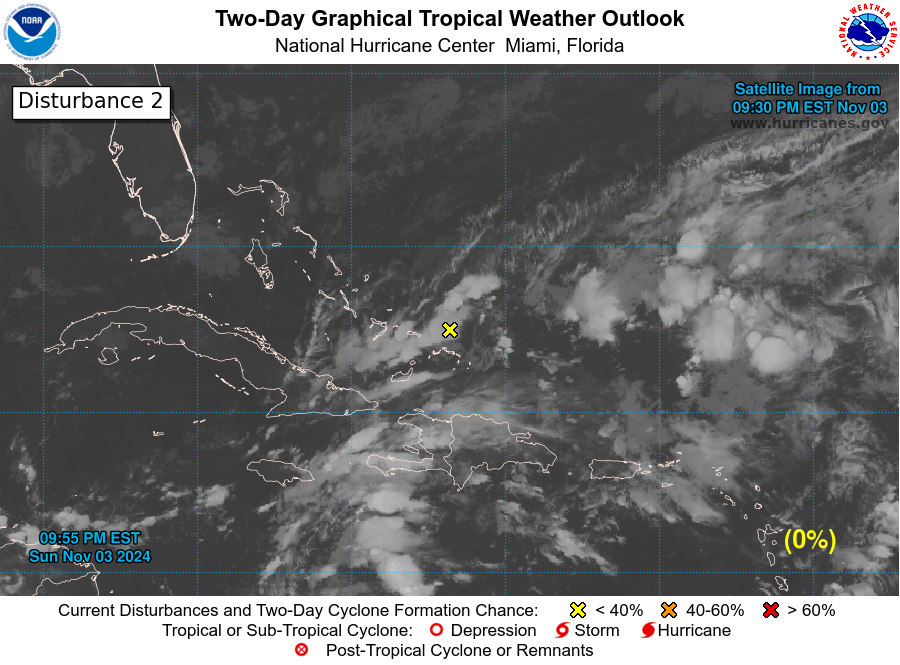
Tormenta Tropical Lisa (Invest 96L)
Tormenta Tropical Lisa (Invest 96L)
Last edited by megadicto on Tue Sep 20, 2016 3:38 pm, edited 5 times in total.
Re: Disturbance 2 (Amarillo 10%) en Africa
ZCZC MIATWOAT ALL
TTAA00 KNHC DDHHMM
TROPICAL WEATHER OUTLOOK
NWS NATIONAL HURRICANE CENTER MIAMI FL
200 PM EDT THU SEP 15 2016
For the North Atlantic...Caribbean Sea and the Gulf of Mexico:
The National Hurricane Center is issuing advisories on Tropical
Storm Ian, located well to the east-northeast of Bermuda, on
Tropical Depression Julia, located offshore of the South Carolina
coast, and on Tropical Depression Twelve, located west-northwest of
the Cabo Verde Islands.
1. Cloudiness and thunderstorms associated with a broad low pressure
system over the northwestern Gulf of Mexico have become a little
better organized since yesterday. Some additional slow development
could occur before the low moves inland over the Texas coast Friday
or Friday night.
* Formation chance through 48 hours...low...20 percent
* Formation chance through 5 days...low...20 percent
2. A tropical wave is expected to move off of the west coast of Africa
by late Friday, and then move generally west-northwestward over the
far eastern Atlantic. Initially, conditions are expected to be
conducive for some development of this system after it moves
offshore, but these conditions are forecast to become less favorable
by early next week.
* Formation chance through 48 hours...low...10 percent
* Formation chance through 5 days...medium...50 percent
Forecaster Beven
Re: Disturbance 2 (Amarillo 10%) en Africa
ZCZC MIATWOAT ALL
TTAA00 KNHC DDHHMM
TROPICAL WEATHER OUTLOOK
NWS NATIONAL HURRICANE CENTER MIAMI FL
800 PM EDT THU SEP 15 2016
For the North Atlantic...Caribbean Sea and the Gulf of Mexico:
The National Hurricane Center is issuing advisories on Tropical
Storm Ian, located well to the east-northeast of Bermuda, on
Tropical Storm Julia, located offshore of the South Carolina
coast, and on Tropical Depression Twelve, located west of the Cabo
Verde Islands.
1. An elongated area of low pressure located over the northwestern Gulf
of Mexico is producing a large area of cloudiness and showers.
Development of this system, if any, should be slow to occur before
it moves inland over Texas by Saturday.
* Formation chance through 48 hours...low...20 percent
* Formation chance through 5 days...low...20 percent
2. A tropical wave is expected to move off of the west coast of Africa
on Friday, and then move generally west-northwestward over the far
eastern Atlantic. Some slight development of this wave is possible
before conditions become less favorable for tropical cyclone
formation early next week.
* Formation chance through 48 hours...low...20 percent
* Formation chance through 5 days...medium...50 percent
Forecaster Avila
-
StormWatch
- Cat. 3

- Posts: 3755
- Joined: Thu Aug 06, 2015 11:39 am
- Location: Texas, USA
Re: Disturbance 2 (Amarillo 20%/50%) en Africa
Invest 96L
Tropical Weather Discussion
NWS National Hurricane Center Miami FL
805 AM EDT SAT SEP 17 2016
A tropical wave located just offshore of the west coast of
Africa extends along 18W-19W from 10N-17N with a 1009 mb low
near 12N18W moving west 5 to 10 kt over the past 24 hours. Wave
coincides with a global model 700 mb trough and is embedded
within a surge of moisture as shown on the Total Precipitable
water imagery. Numerous strong convection is within 30/45 nm of
a line from 12N21W to 16N17W. Scattered moderate to isolated
strong convection are from 11N13N between 18W-22W and from 13N-
18N west of 23W to just inland over Africa. Environmental
conditions appear conducive for gradual development, and a
tropical depression could form by the middle of next week.
Regardless of tropical cyclone formation, this system could
bring rain and gusty winds to portions of the Cabo Verde Islands
during the next couple of days. This system has a medium chance
of tropical formation within the next 48 hours.
Member Since 2005
For official information, please refer to NHC: https://www.nhc.noaa.gov
Hurricane’s hit Puerto Rico:
San Felipe 1928, San Ciprián 1932, Santa Clara 1956, Hugo 1989, Marilyn 1995, Hortense 1996, Georges 1998, Maria 2017, Fiona 2022
Model Runs:
GFS:
[5:30 AM/PM, 11:30 AM/PM]
HWRF, GFDL, UKMET, NAVGEM:
[6:30-8:00 AM/PM, 12:30-2:00 AM/PM]
ECMWF:
[1:45 AM/PM]
-
StormWatch
- Cat. 3
- Posts: 3755
- Joined: Thu Aug 06, 2015 11:39 am
- Location: Texas, USA
Re: Disturbance 2 (Amarillo 20%/50%) en Africa
Invest 96L

Member Since 2005
For official information, please refer to NHC: https://www.nhc.noaa.gov
Hurricane’s hit Puerto Rico:
San Felipe 1928, San Ciprián 1932, Santa Clara 1956, Hugo 1989, Marilyn 1995, Hortense 1996, Georges 1998, Maria 2017, Fiona 2022
Model Runs:
GFS:
[5:30 AM/PM, 11:30 AM/PM]
HWRF, GFDL, UKMET, NAVGEM:
[6:30-8:00 AM/PM, 12:30-2:00 AM/PM]
ECMWF:
[1:45 AM/PM]
For official information, please refer to NHC: https://www.nhc.noaa.gov
Hurricane’s hit Puerto Rico:
San Felipe 1928, San Ciprián 1932, Santa Clara 1956, Hugo 1989, Marilyn 1995, Hortense 1996, Georges 1998, Maria 2017, Fiona 2022
Model Runs:
GFS:
[5:30 AM/PM, 11:30 AM/PM]
HWRF, GFDL, UKMET, NAVGEM:
[6:30-8:00 AM/PM, 12:30-2:00 AM/PM]
ECMWF:
[1:45 AM/PM]
-
StormWatch
- Cat. 3
- Posts: 3755
- Joined: Thu Aug 06, 2015 11:39 am
- Location: Texas, USA
Re: Disturbance 2 (Amarillo 20%/50%) en Africa
Jjajajjajjjjjjaja
Invest 96L

Invest 96L
Member Since 2005
For official information, please refer to NHC: https://www.nhc.noaa.gov
Hurricane’s hit Puerto Rico:
San Felipe 1928, San Ciprián 1932, Santa Clara 1956, Hugo 1989, Marilyn 1995, Hortense 1996, Georges 1998, Maria 2017, Fiona 2022
Model Runs:
GFS:
[5:30 AM/PM, 11:30 AM/PM]
HWRF, GFDL, UKMET, NAVGEM:
[6:30-8:00 AM/PM, 12:30-2:00 AM/PM]
ECMWF:
[1:45 AM/PM]
For official information, please refer to NHC: https://www.nhc.noaa.gov
Hurricane’s hit Puerto Rico:
San Felipe 1928, San Ciprián 1932, Santa Clara 1956, Hugo 1989, Marilyn 1995, Hortense 1996, Georges 1998, Maria 2017, Fiona 2022
Model Runs:
GFS:
[5:30 AM/PM, 11:30 AM/PM]
HWRF, GFDL, UKMET, NAVGEM:
[6:30-8:00 AM/PM, 12:30-2:00 AM/PM]
ECMWF:
[1:45 AM/PM]
-
StormWatch
- Cat. 3
- Posts: 3755
- Joined: Thu Aug 06, 2015 11:39 am
- Location: Texas, USA
Re: Disturbance 2 (Amarillo 20%/50%) en Africa
Invest 96L floater ya disponible!
http://www.ssd.noaa.gov/PS/TROP/floater ... oater.html
http://www.ssd.noaa.gov/PS/TROP/floater ... oater.html
Member Since 2005
For official information, please refer to NHC: https://www.nhc.noaa.gov
Hurricane’s hit Puerto Rico:
San Felipe 1928, San Ciprián 1932, Santa Clara 1956, Hugo 1989, Marilyn 1995, Hortense 1996, Georges 1998, Maria 2017, Fiona 2022
Model Runs:
GFS:
[5:30 AM/PM, 11:30 AM/PM]
HWRF, GFDL, UKMET, NAVGEM:
[6:30-8:00 AM/PM, 12:30-2:00 AM/PM]
ECMWF:
[1:45 AM/PM]
For official information, please refer to NHC: https://www.nhc.noaa.gov
Hurricane’s hit Puerto Rico:
San Felipe 1928, San Ciprián 1932, Santa Clara 1956, Hugo 1989, Marilyn 1995, Hortense 1996, Georges 1998, Maria 2017, Fiona 2022
Model Runs:
GFS:
[5:30 AM/PM, 11:30 AM/PM]
HWRF, GFDL, UKMET, NAVGEM:
[6:30-8:00 AM/PM, 12:30-2:00 AM/PM]
ECMWF:
[1:45 AM/PM]
-
StormWatch
- Cat. 3
- Posts: 3755
- Joined: Thu Aug 06, 2015 11:39 am
- Location: Texas, USA
Re: Disturbance 2 (Amarillo 20%/50%) en Africa
A tropical wave located just offshore of the west coast of Africa is
accompanied by disorganized shower and thunderstorm activity.
Environmental conditions appear conducive for gradual development,
and a tropical depression could form by the middle of next week
while this system moves westward to west-northwestward across the
eastern tropical Atlantic. Regardless of tropical cyclone
formation, this system could bring rain and gusty winds to portions
of the Cabo Verde Islands during the next couple of days.
Formation chance through 48 hours...low...30 percent
Formation chance through 5 days...medium...60 percent
Member Since 2005
For official information, please refer to NHC: https://www.nhc.noaa.gov
Hurricane’s hit Puerto Rico:
San Felipe 1928, San Ciprián 1932, Santa Clara 1956, Hugo 1989, Marilyn 1995, Hortense 1996, Georges 1998, Maria 2017, Fiona 2022
Model Runs:
GFS:
[5:30 AM/PM, 11:30 AM/PM]
HWRF, GFDL, UKMET, NAVGEM:
[6:30-8:00 AM/PM, 12:30-2:00 AM/PM]
ECMWF:
[1:45 AM/PM]
For official information, please refer to NHC: https://www.nhc.noaa.gov
Hurricane’s hit Puerto Rico:
San Felipe 1928, San Ciprián 1932, Santa Clara 1956, Hugo 1989, Marilyn 1995, Hortense 1996, Georges 1998, Maria 2017, Fiona 2022
Model Runs:
GFS:
[5:30 AM/PM, 11:30 AM/PM]
HWRF, GFDL, UKMET, NAVGEM:
[6:30-8:00 AM/PM, 12:30-2:00 AM/PM]
ECMWF:
[1:45 AM/PM]