Re: 0-50% sistema sobre Africa que modelos desarrollan
Posted: Mon Aug 29, 2016 10:09 am
Pido opinion de los sabios de este foro.
¿Esta informacion de esta mañana va en acorde con lo que se esta discutiendo?
New Tropical Wave Will Move Into The Eastern Atlantic Tonight Will Need To Be Monitored Closely:
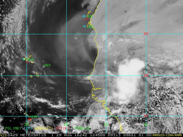
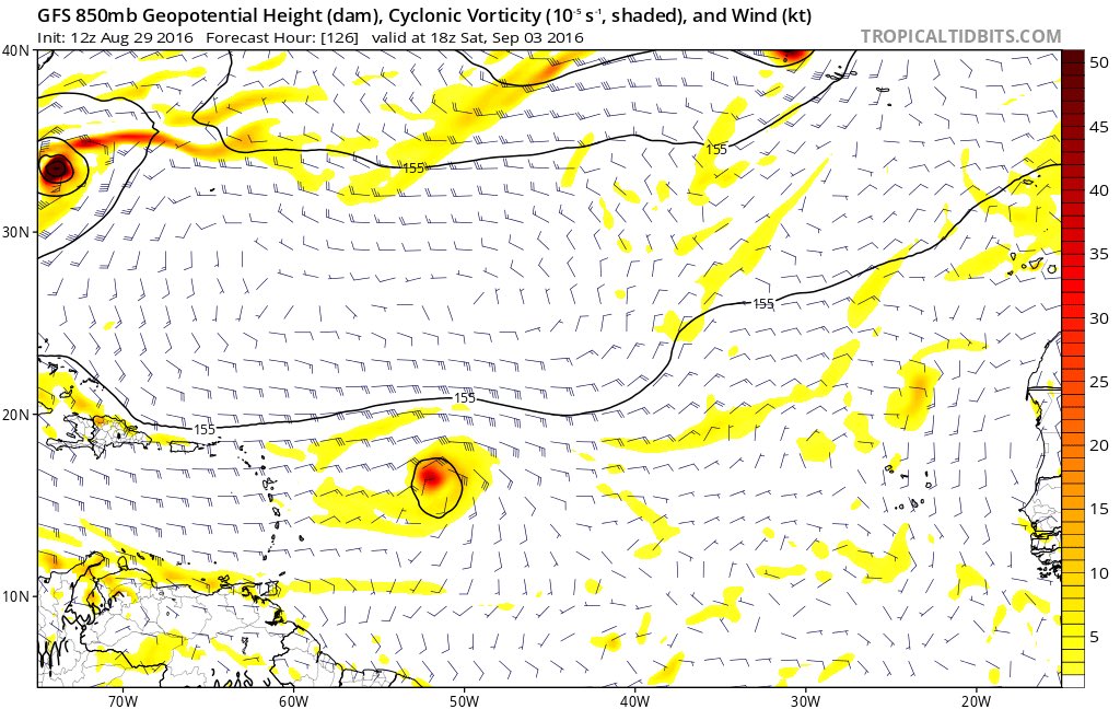
A tropical wave is expected to move off of the coast of Africa into the eastern Atlantic tonight. Environmental conditions are forecast to be favorable for this tropical wave to slowly develop during the middle and last part of this week. This is a tropical wave that will need to be monitored very closely as the upper level pattern is favorable for this system to not only become a tropical storm and possibly even a hurricane, but also be driven westward underneath a large area of high pressure. In particular, those of you in the northern Lesser Antilles, Virgin Islands and Puerto Rico should closely monitor this new tropical wave as it is currently forecast to move across these areas around next Monday.
At this point, I want to see how organized this tropical wave is when it moves into the eastern Atlantic and then go from there. If we do see a large ridge of high pressure set up across the Atlantic, then this is a system that may really need to be watched, not only for the eastern Caribbean, but also for the Bahamas and the US East Coast. For now, however, it is something to just watch.
SOURCE: Crown Weather Services
Opinen para que los que estamos aprendiendo en Cycloforums...
¿Esta informacion de esta mañana va en acorde con lo que se esta discutiendo?
New Tropical Wave Will Move Into The Eastern Atlantic Tonight Will Need To Be Monitored Closely:
A tropical wave is expected to move off of the coast of Africa into the eastern Atlantic tonight. Environmental conditions are forecast to be favorable for this tropical wave to slowly develop during the middle and last part of this week. This is a tropical wave that will need to be monitored very closely as the upper level pattern is favorable for this system to not only become a tropical storm and possibly even a hurricane, but also be driven westward underneath a large area of high pressure. In particular, those of you in the northern Lesser Antilles, Virgin Islands and Puerto Rico should closely monitor this new tropical wave as it is currently forecast to move across these areas around next Monday.
At this point, I want to see how organized this tropical wave is when it moves into the eastern Atlantic and then go from there. If we do see a large ridge of high pressure set up across the Atlantic, then this is a system that may really need to be watched, not only for the eastern Caribbean, but also for the Bahamas and the US East Coast. For now, however, it is something to just watch.
SOURCE: Crown Weather Services
Opinen para que los que estamos aprendiendo en Cycloforums...