Aquí encontrarás todo lo relacionado al la meteorología en Puerto Rico y las condiciones del tiempo actuales, así como los huracanes que se desarrollen durante las temporadas ciclónicas, actualizados por expertos y aficionados a la meteorología de todo el pais! Este es tu foro! Leelo, escribe en el y disfrútalo! Cycloman.
Segun esto, si es que se da, seria una ruta bien similar a la de San Felipe___San felipe entro un chispito mas al oeste entre Arroyo y guayama, saliendo por donde hoy ubica el aeropuerto de Aguadilla.
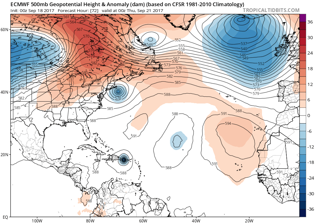
Yo digo que Maria va a entrar un poco mas al este y el ojo va a arropar la zona metropolitana (ojo Rock!)
Como llego a esa conclusion?...muy sencilo!_Uno mira el mapa, mira el satelite...dejo correr la mente y..."este va a pasar por aqui"
O sea, que son vainas de uno, adivinaciones mias...y como no hay pobre que sea adivino y yo soy pobre, usted siga lo que a esta hora dice el americano...una ruta transversal sobre el territorio de la isla de sureste a noroeste.
Saludos David79
Si, un poco complicado en un piso alto, pero ya hice todos los preparativos. Solo falta terminar de correr Las tormenteras.
Complicado y medio, yo pase Hugo en un piso 20, tres semanas sin luz y no recuerdo cuantas sin agua potable, tenias que bajar a diario, a llenr dos cubetas de agua (era racionada) en un camion cercano que puso el municipio...y a subir los 20 pisos con las cubetas...esta vez llenas__Lo recuerdo y me da cosas!
David79
Ya vengo
"Georgy Girl", The Seekers
"Back for Good", Take That "Perfectionist", SAGA
"Graves Into Gardens", Elevation Worship ft. Brandon Lake
"Thunder", Imagine Dragons
"Viva la Vida", Coldplay
Honestamente, sabemos que esperar de este huracan? sabremos realmente cual seria el resultado tan pronto se aleje Maria de nuestra area si se cumple el pronostico?
Estamos mejor, igual o peor que cuando Georges y Hugo? La gente tomara la escacez de agua, comida y la falta de energia electrica igual, mejor o peor que cuando Hugo o Georges?
De recibir este azote de un CAt 4 poderoso, eatariamos en realidad cerca de una crisis humanitaria? "martial Law"?
No se, me gustaria leerles y poder idealizar un posible panorama.
Quiero hacerles un acercamiento a toda la comunidad del foro, a unirnos como grupo despues del Huracan, y ayudar a los mas necesitados. Hacer algo como "Cycloforum le da la mano a PR". Ayudar a remover escombros...salir a la calle, ayudar a la comunidad...proveerle tal vez ayuda con comida etc...ayudarlos a reconstruir a PR. Ayudar como comunidad de aficionados a recostruir a PR. Creo que podemos y hariamos una labor social encomiable. Que piensan?
Gracias!
Felix Castro
Súper claro que si me uniría a tan encomiable idea.
Hugo1989 wrote: ↑Mon Sep 18, 2017 12:35 am
Saludos!
Honestamente, sabemos que esperar de este huracan? sabremos realmente cual seria el resultado tan pronto se aleje Maria de nuestra area si se cumple el pronostico?
Estamos mejor, igual o peor que cuando Georges y Hugo? La gente tomara la escacez de agua, comida y la falta de energia electrica igual, mejor o peor que cuando Hugo o Georges?
De recibir este azote de un CAt 4 poderoso, eatariamos en realidad cerca de una crisis humanitaria? "martial Law"?
No se, me gustaria leerles y poder idealizar un posible panorama.
Decir peor es poco.
Ahora no solo es la luz, es el celular, es la internet.
Hay gente que te soportan uno o dos dias sin celulares...pero no los dejes una semana, se tiran del puente de Cayey.
Y ponga el caso de los millennials...no saben lo que es un ciclon!
A mi me preocupa lo del ojo...va a pasar lento sobre mucha area poblada, en horas del dia...hay gente que no conoce la dinamica de un huracan de esta magnitud y lo que sucede cuando el ojo pasa por un area determinada, se calma el viento...que sale el sol...
Mas del 90% de las personas que vivieron un evento similar a este ya se han ido con Los Panchos de aquel lao de la verja...a muchos se los llevo San Felipe y el resto, de pura vejez.
Las horas diran...pero, no es comodo pensar en esto...en la otra pagina tengo el satelite y Maria lo que lleva es como un volcan en el centro...ya yo ni un C5 descarto mirando lo que veo.
Bueno mi gente ya solo queda esperar y continuar preparándonos en este si me voy a preparar bien por qué en los pasados como que no les he hecho mucho caso y hago preparativos muy ambiguos. Pero en este si . Y nada espero que si llega este sistema sea de gran utilidad para nuestras observaciones y estudios meteorológicos. Y Félix cuenta conmigo para darle forma a esa idea.
Yo me anoto tambien. Fui voluntario de la Cruz Roja desde Hugo hasta Hortense. La satisfaccion de ayudar en la recuperacion de PR es enorme. Cuenten tambien conmigo.
"Georgy Girl", The Seekers
"Back for Good", Take That "Perfectionist", SAGA
"Graves Into Gardens", Elevation Worship ft. Brandon Lake
"Thunder", Imagine Dragons
"Viva la Vida", Coldplay
ROCKstormSJ4315 wrote: ↑Mon Sep 18, 2017 1:16 am
Yo me anoto tambien. Fui voluntario de la Cruz Roja desde Hugo hasta Hortense. La satisfaccion de ayudar en la recuperacion de PR es enorme. Cuenten tambien conmigo.
Ea olvide Georges, hasta ahi fui voluntario.
"Georgy Girl", The Seekers
"Back for Good", Take That "Perfectionist", SAGA
"Graves Into Gardens", Elevation Worship ft. Brandon Lake
"Thunder", Imagine Dragons
"Viva la Vida", Coldplay
BULLETIN
Hurricane Maria Intermediate Advisory Number 7A
NWS National Hurricane Center Miami FL AL152017
200 AM AST Mon Sep 18 2017
...STRENGTHENING MARIA EXPECTED TO BECOME A MAJOR HURRICANE BY THE
TIME IT REACHES THE LEEWARD ISLANDS...
SUMMARY OF 200 AM AST...0600 UTC...INFORMATION
----------------------------------------------
LOCATION...14.4N 59.0W
ABOUT 90 MI...145 KM NNE OF BARBADOS
ABOUT 170 MI...270 KM ESE OF DOMINICA
MAXIMUM SUSTAINED WINDS...90 MPH...150 KM/H
PRESENT MOVEMENT...WNW OR 290 DEGREES AT 13 MPH...20 KM/H
MINIMUM CENTRAL PRESSURE...977 MB...28.85 INCHES
WATCHES AND WARNINGS
--------------------
CHANGES WITH THIS ADVISORY:
None.
SUMMARY OF WATCHES AND WARNINGS IN EFFECT:
A Hurricane Warning is in effect for...
* Guadeloupe
* Dominica
* St. Kitts, Nevis, and Montserrat
* Martinique
A Tropical Storm Warning is in effect for...
* Antigua and Barbuda
* Saba and St. Eustatius
* St. Lucia
A Hurricane Watch is in effect for...
* U.S. Virgin Islands
* British Virgin Islands
* Saba and St. Eustatius
* St. Maarten
* St. Martin and St. Barthelemy
* Anguilla
A Tropical Storm Watch is in effect for...
* Barbados
* St. Vincent and the Grenadines
A Hurricane Warning means that hurricane conditions are expected
somewhere within the warning area. Preparations to protect life and
property should be rushed to completion.
A Tropical Storm Warning means that tropical storm conditions are
expected somewhere within the warning area within 36 hours.
A Hurricane Watch means that hurricane conditions are possible
within the watch area. A watch is typically issued 48 hours
before the anticipated first occurrence of tropical-storm-force
winds, conditions that make outside preparations difficult or
dangerous.
A Tropical Storm Watch means that tropical storm conditions are
possible within the watch area, generally within 48 hours.
Interests elsewhere in the Lesser Antilles, Puerto Rico, and the
Dominican Republic should monitor the progress of this system.
Additional Hurricane and Tropical storm Warnings may be issued for
portion of the Leeward and Virgin Islands on today, and
Hurricane Watches will likely be issued for Puerto Rico and the
nearby islands this morning.
For storm information specific to your area in the United
States, including possible inland watches and warnings, please
monitor products issued by your local National Weather Service
forecast office. For storm information specific to your area outside
the United States, please monitor products issued by your national
meteorological service.
DISCUSSION AND 48-HOUR OUTLOOK
------------------------------
At 200 AM AST (0600 UTC), the center of Hurricane Maria was located
by Martinique radar near latitude 14.4 North, longitude 59.0 West.
Maria is moving toward the west-northwest near 13 mph (20 km/h), and
this motion with a decrease in forward speed is expected through
Tuesday night. On the forecast track, the center of Maria will move
across the Leeward Islands late today and tonight and then over the
extreme northeastern Caribbean Sea Tuesday and Tuesday night.
Maximum sustained winds have increased to near 90 mph (150 km/h)
with higher gusts. Rapid strengthening is forecast during the next
48 hours, and Maria is expected to become a major hurricane before
it moves through the Leeward Islands.
Hurricane-force winds extend outward up to 15 miles (30 km) from
the center and tropical-storm-force winds extend outward up to 105
miles (165 km).
The estimated minimum central pressure is 977 mb (28.85 inches).
HAZARDS AFFECTING LAND
----------------------
WIND: Hurricane conditions are first expected within portions of
the Leeward Islands by late today, with tropical storm conditions
beginning during the day today. Hurricane conditions are possible
within the hurricane watch area by Tuesday, with tropical storm
conditions possible tonight. Tropical storm conditions are possible
in the tropical storm watch area through tonight.
STORM SURGE: A dangerous storm surge accompanied by large and
destructive waves will raise water levels by as much as 5 to 7 feet
above normal tide levels near where the center of Maria moves
across the Leeward Islands.
RAINFALL: Maria is expected to produce total rain accumulations of
6 to 12 inches with isolated maximum amounts of 20 inches across the
central and southern Leeward Islands, including Puerto Rico and the
U.S. and British Virgin Islands, through Wednesday night. Maria is
also expected to produce total rain accumulations of 2 to 4 inches
with isolated maximum amounts of 8 inches over the remaining
northern Leeward Islands from Barbuda to Anguilla, as well as the
Windward Islands and Barbados. Rainfall on all of these islands
could cause life-threatening flash floods and mudslides.
SURF: Swells generated by Maria are affecting the Lesser Antilles.
These swells are likely to cause life-threatening surf and rip
current conditions. Please consult products from your local
weather office.
NEXT ADVISORY
-------------
Next complete advisory at 500 AM AST.
$$
Forecaster Pasch
"Georgy Girl", The Seekers
"Back for Good", Take That "Perfectionist", SAGA
"Graves Into Gardens", Elevation Worship ft. Brandon Lake
"Thunder", Imagine Dragons
"Viva la Vida", Coldplay