StormWatch wrote: ↑Sat Sep 21, 2019 9:57 am
Villafañe wrote: ↑Sat Sep 21, 2019 7:21 am
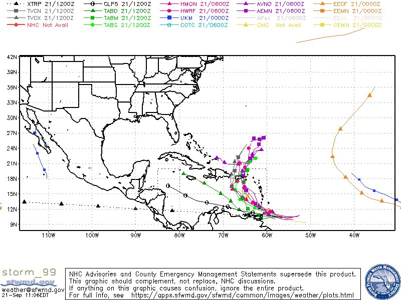
Las primeras imágenes del satélite de esta mañana con bastante convección alrededor de la baja presión... Invest 99l. Veremos que pasa con este prospecto. La oficina local de

el SNM puso esto así que pendientes. If this system develops into a tropical cyclone, it could bring tropical storm or hurricane conditions to the local islands Tuesday afternoon into Wednesday.
Donde lo posteo? En Twitter?
Saludos y buen día!
Lo encontré

Model guidance has not changed much and favors a wetter weather
pattern due to the passage of a potent tropical wave or potential
tropical cyclone across the region. As of 2 AM AST, this wave was
located several hundred miles east of the Windward Islands with a
40/50% chance of developing into a tropical cyclone in 2/5 days.
Regardless of development, heavy rainfall is anticipated over the
region. If this system develops into a tropical cyclone, it could
bring tropical storm or hurricane conditions to the local islands
Tuesday afternoon into Wednesday. Once this system moves into the
Atlantic waters and north of the local islands, both GFS and
ECMWF models suggest that moisture associated to its trailing
edge will sink south under the influence of a northerly flow of a
deep- layer high moving off the eastern coast of the United States
into the western Atlantic. This moisture will hold across the
region and affect the local islands through at least Friday,
resulting in enhanced shower and thunderstorm activity. Although
there is high uncertainty, the next tropical wave is expected to
approach the region by Saturday