NWS NATIONAL HURRICANE CENTER MIAMI FL
200 AM EDT FRI JUL 29 2016
For the North Atlantic...Caribbean Sea and the Gulf of Mexico:
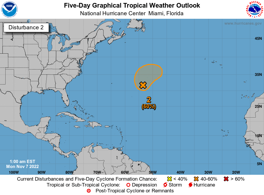
Shower activity associated with a tropical wave and a low pressure
system centered a couple of hundred miles south-southeast of the
Cabo Verde Islands has increased during the past several hours, but
the overall organization has changed little. This system has some
potential for development during the next day or two, before the
disturbance encounters a less favorable environment over the central
tropical Atlantic next week.
* Formation chance through 48 hours...low...30 percent
* Formation chance through 5 days...medium...40 percent
Forecaster Avila