
Search
Search found 46 matches
- Sun Sep 08, 2019 8:37 am
- Forum: Ciclón Caribe
- Topic: Ex Invest 94l
- Replies: 228
- Views: 46679
- Sat Sep 07, 2019 1:35 am
- Forum: Ciclón Caribe
- Topic: Ex Invest 94l
- Replies: 228
- Views: 46679
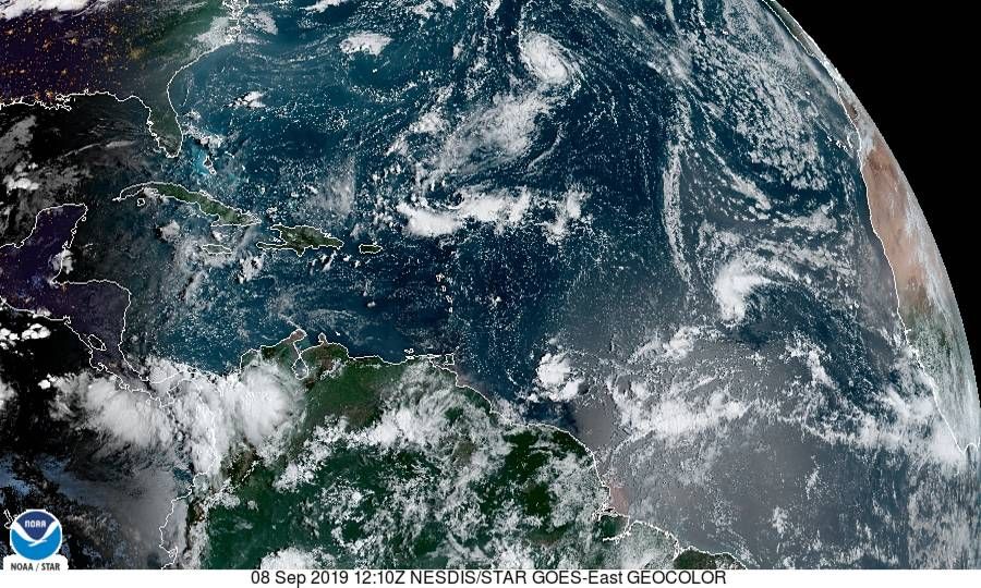
Re: Invest 94l con 10%/70%
En el boletín de las 2 a.m. bajaron el porciento a 60% en 5 dias ZCZC MIATWOAT ALL TTAA00 KNHC DDHHMM Tropical Weather Outlook NWS National Hurricane Center Miami FL 200 AM EDT Sat Sep 7 2019 For the North Atlantic...Caribbean Sea and the Gulf of Mexico: The National Hurricane Center is issuing advi...
- Wed Sep 04, 2019 2:51 am
- Forum: Ciclón Caribe
- Topic: Huracán Dorian.
- Replies: 695
- Views: 94720
Re: Huracán Dorian.
Boletín 2 am BULLETIN Hurricane Dorian Intermediate Advisory Number 43A NWS National Hurricane Center Miami FL AL052019 200 AM EDT Wed Sep 04 2019 ...TROPICAL STORM CONDITIONS OCCURRING ALONG PORTIONS OF THE NORTHEASTERN COAST OF FLORIDA... SUMMARY OF 200 AM EDT...0600 UTC... INFORMATION -----------...
- Wed Sep 04, 2019 2:45 am
- Forum: Ciclón Caribe
- Topic: Ex Invest 94l
- Replies: 228
- Views: 46679
Re: Onda tropical saldra el 4/9/19 de Africa/0-70%
Imagen reciente no se actualiza
- Wed Sep 04, 2019 2:38 am
- Forum: Ciclón Caribe
- Topic: Ex Invest 94l
- Replies: 228
- Views: 46679
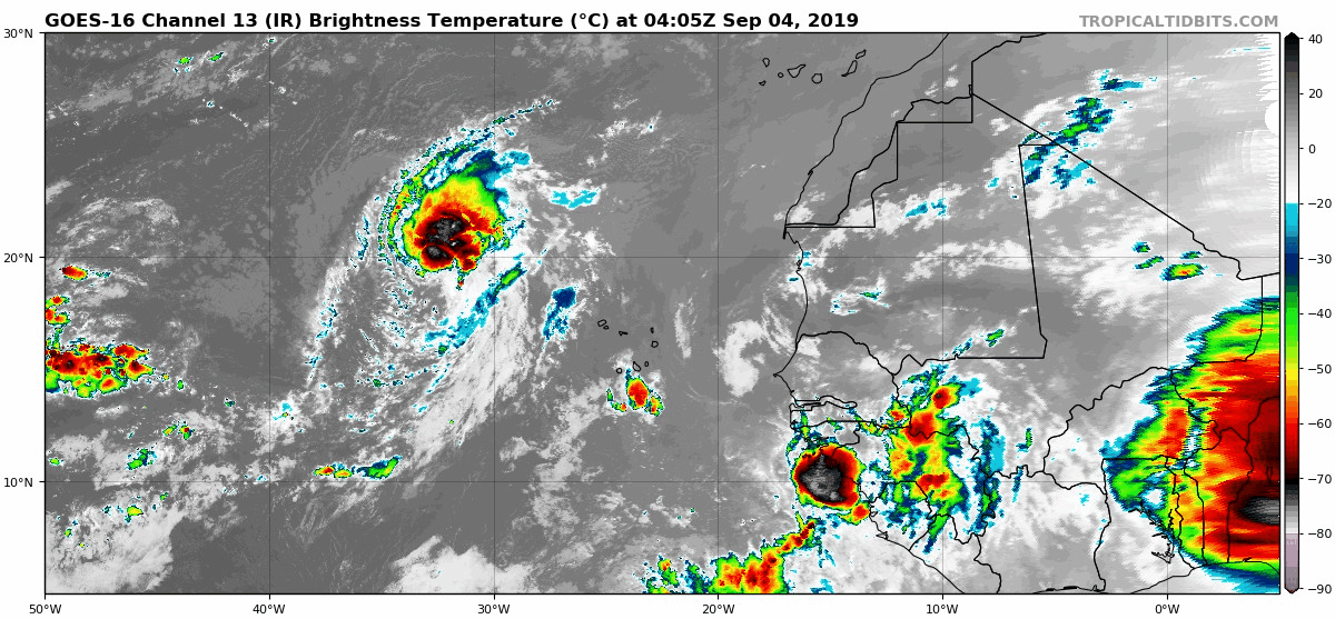
Re: Onda tropical saldra el 4/9/19 de Africa/0-70%
Boletín 2 a.m. 4 se septiembre. Se queda en 70% en 5 días A tropical wave is forecast to emerge over the far eastern tropical Atlantic between Africa and the Cabo Verde Islands later today. Environmental conditions are forecast to be conducive for development, and a tropical depression is likely to ...
- Wed Sep 04, 2019 2:20 am
- Forum: Ciclón Caribe
- Topic: Ex Invest 94l
- Replies: 228
- Views: 46679
Re: Onda tropical saldra el 4/9/19 de Africa/0-70%
El modelo GFS lleva dos corridas acercandolo a PR 🇵🇷 con una trayectoria similar a Dorian pasando cerca se las Bahamas modelo GFS 18z 3sep http://i187.photobucket.com/albums/x121/bayaney/Mobile%20Uploads/gfs_z850_vort_eatl_fh150-288-2.gif Corrida modelo GFS 0z 4 sep http://i187.photobucket.com/album...
- Wed Aug 28, 2019 10:57 am
- Forum: Ciclón Caribe
- Topic: Huracán Dorian.
- Replies: 695
- Views: 94720
Re: Tormenta Tropical Dorian
TROPICAL STORM DORIAN FORECAST/ADVISORY NUMBER 17 NWS NATIONAL HURRICANE CENTER MIAMI FL AL052019 1500 UTC WED AUG 28 2019 CHANGES IN WATCHES AND WARNINGS WITH THIS ADVISORY... A HURRICANE WARNING HAS BEEN ISSUED FOR VIEQUES...CULEBRA...AND THE U.S. VIRGIN ISLANDS. SUMMARY OF WATCHES AND WARNINGS IN...
- Sun Aug 25, 2019 5:04 pm
- Forum: Ciclón Caribe
- Topic: Huracán Dorian.
- Replies: 695
- Views: 94720
Re: Tormenta Tropical Dorian
ADDITIONAL WATCHES OR WARNINGS COULD BE ISSUED TONIGHT FOR PORTIONS OF THE WINDWARD AND LEEWARD ISLANDS. ELSEWHERE...INTERESTS IN PUERTO RICO...THE VIRGIN ISLANDS...AND HISPANIOLA SHOULD MONITOR THE PROGRESS OF DORIAN. TROPICAL STORM CENTER LOCATED NEAR 11.5N 54.2W AT 25/2100Z POSITION ACCURATE WITH...
- Sun Aug 25, 2019 4:58 pm
- Forum: Ciclón Caribe
- Topic: Huracán Dorian.
- Replies: 695
- Views: 94720
Re: Tormenta Tropical Dorian
Se ha tardado en salir el boletín de las 5PM
- Fri Sep 21, 2018 1:31 am
- Forum: Ciclón Caribe
- Topic: Tormenta Kirk
- Replies: 120
- Views: 23643
Re: Invest 99L saliendo de Africa... 10%-40%
TWO 2am- Sube a 50% en 5 días A tropical wave located more than 700 miles southeast of the Cabo Verde Islands. Some gradual development of this system is possible during the next several days as the disturbance moves westward at 15 to 20 mph across the low latitudes of the eastern and central tropic...