Aquí encontrarás todo lo relacionado al la meteorología en Puerto Rico y las condiciones del tiempo actuales, así como los huracanes que se desarrollen durante las temporadas ciclónicas, actualizados por expertos y aficionados a la meteorología de todo el pais! Este es tu foro! Leelo, escribe en el y disfrútalo! Cycloman.
Hurricane’s hit Puerto Rico: San Felipe 1928, San Ciprián 1932, Santa Clara 1956, Hugo 1989, Marilyn 1995, Hortense 1996, Georges 1998, Maria 2017, Fiona 2022
Arlequín wrote: ↑Sat Sep 25, 2021 8:15 am
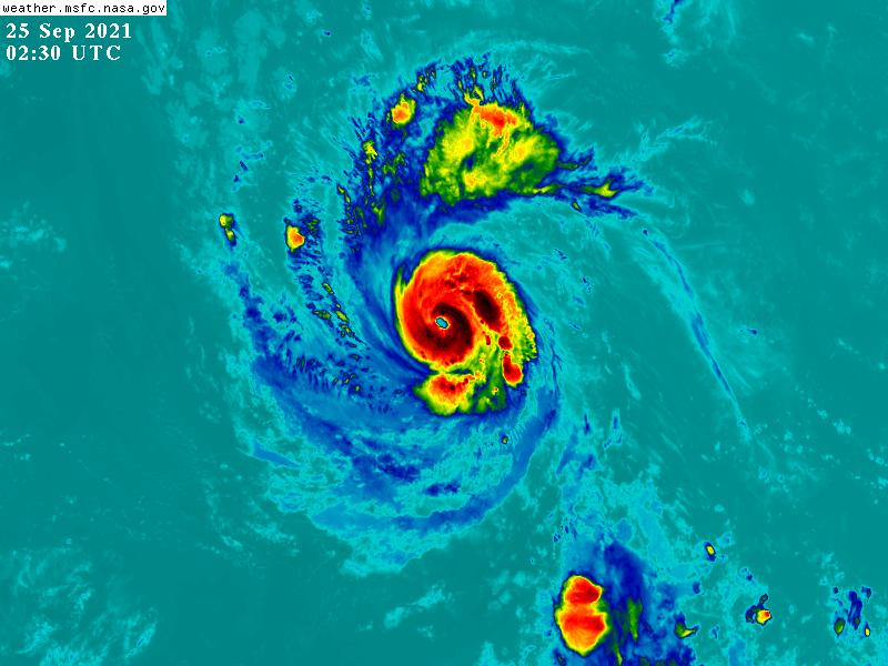
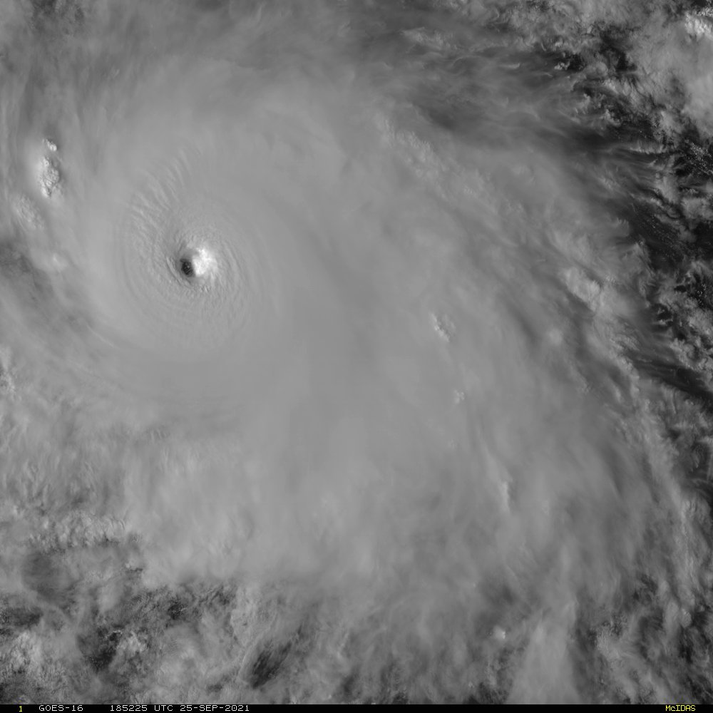
Sam parece que sigue su intensificacion, ese ojo se ve mucho mejor ahora que en las pasadas horas
Arlequín no quiere que vean "el ojo"
Es que lleva par de millas moviéndose franco al Oeste
Se ve un movimiento franco al oeste hace ratito... aunque la ruta al norte es la oficial y hasta el momento muy confiable... me pregunto cuando sale la Vaguada o si ya está en el panorama haciendo su función? También creo que había alguien en foro que siempre ponía los mapas de Upper-Level Steering de movimiento creo q era Rockstorm.
Aquí la discusión a las 11 pm, excelente las observaciones que se hacen en este foro el wobble al oeste mencionado en la discusión.
000 WTNT43 KNHC 251441 TCDAT3 Hurricane Sam Discussion Number 12 NWS National Hurricane Center Miami FL AL182021 1100 AM AST Sat Sep 25 2021
Sam has continued to intensify this morning and now has a complete ring of deep convection with cloud tops colder than -70 degrees C surrounding a mostly clear, small eye. The latest subjective Dvorak intensity estimates from TAFB and SAB are both 102 kt, while the combined objective Dvorak intensity estimates from the UW-CIMSS SATCON and ADT is 110 kt. Based on this data, the initial intensity has been increased to 105 kt for this advisory, making Sam a major hurricane. The cyclone remains compact, with hurricane-force winds extending only 20 n mi from the center. The hurricane wobbled to the west over the past few hours. However, the 12-hour motion is west-northwest at 9 kt.
There are no changes to the forecast track reasoning. The ridge the north of Sam responsible for its current motion is forecast to shift to the east in a couple of days as a deep-layer trough establishes itself over the western Atlantic. Sam is forecast to turn northwestward around the southwestern periphery of the ridge in about 48 h, and gradually increase its forward speed thereafter.
The model guidance continues to be in very good agreement with this scenario, and the latest NHC track forecast is unchanged from the previous one. It should be noted that the westernmost guidance continues to be the ECMWF ensemble mean, whose members have had a low bias in the intensity of Sam, which is likely contributing to the westward track bias. Based on the NHC forecast, and all of the other guidance, Sam is expected to still be well to the east or northeast of the northern Leeward Islands through day 5. Environmental conditions support further strengthening in the short term, and Sam is expected to become a category 4 hurricane by Sunday. In a few days, some southwesterly shear is forecast to develop as the cyclone begins to round the periphery of the subtropical ridge. Although this should cause Sam to weaken, it is still expected to remain a powerful hurricane throughout the 5-day forecast period. The latest NHC intensity forecast is near the previous one, which remains slightly above the various consensus solutions through 72 h, and then closely follows the consensus thereafter.
Hurricane’s hit Puerto Rico: San Felipe 1928, San Ciprián 1932, Santa Clara 1956, Hugo 1989, Marilyn 1995, Hortense 1996, Georges 1998, Maria 2017, Fiona 2022