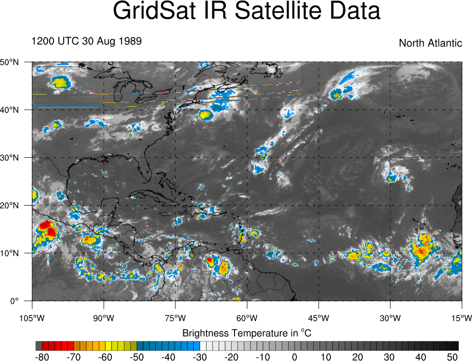
ahora miren esta onda

Pueden ver las imagenes de satelite desde los 80s en este link
http://www.atmos.albany.edu/student/ppapin/gridsat.php

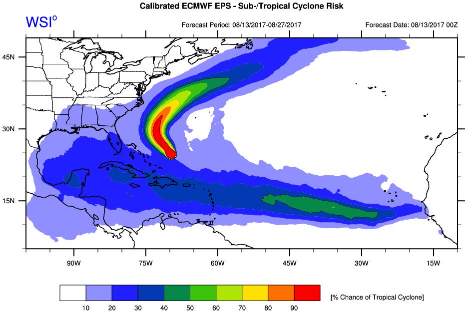
Buena comparación, tal vez si su trayectoria pudiera ser due West!Arlequín wrote: ↑Sun Aug 13, 2017 10:26 am Miren como era Hugo cuando estaba cerca de Cabo Verde
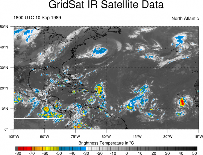
ahora miren esta onda
Pueden ver las imagenes de satelite desde los 80s en este link
http://www.atmos.albany.edu/student/ppapin/gridsat.php